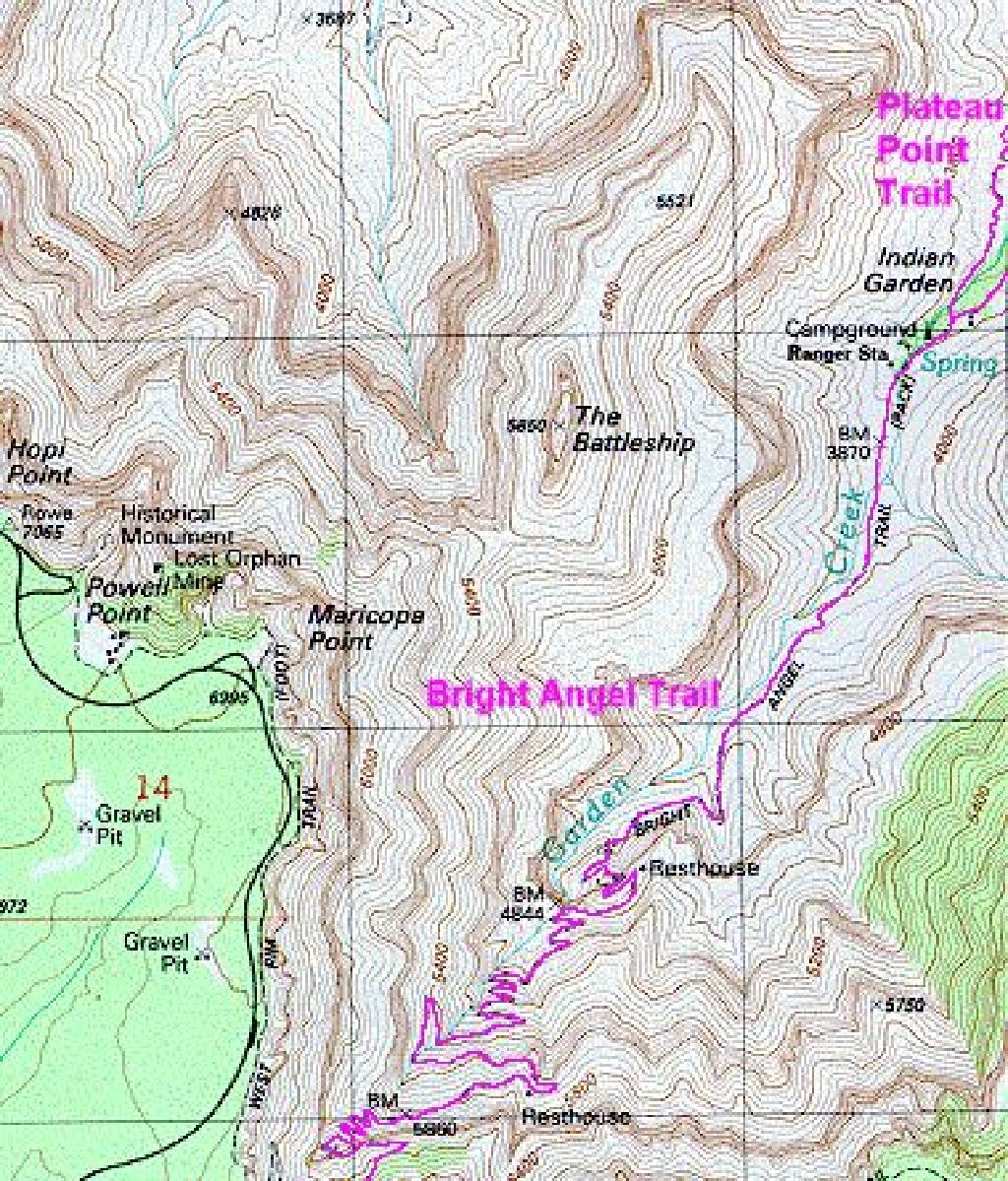
Topo map of South Rim and Bright Angel Trail.
In 1994, my suddenly adventurous then-20-yr old daugther, Kathy, talked me into taking a hike down into the Grand Canyon. We camped
at the
South Rim and hiked down the Bright Angel Trail to Plateau Point. These photos were taken along the way with both a conventional
camera
and a panoramic view camera.
At daybreak we hit the trail and within 45 min we were at the base of the face at the South Rim. This was approximately 3 miles. The total
journey was only going to be 6 mi so this was a piece of cake, right? Wrong! We stopped at Indian Garden for a few minutes to rest and
snack.
But we still made it to Plateau Point in about 2 hr. Well the hike back out took a little longer. We finally crawled out onto the South Rim
approximately 12 hr after we started, a humbling avg of 1 mph, which isn't bad for some back country hiking. Only thing is, this trail was
supposed
to be the boulevard of the Grand Canyon trails. But we got lots of photos and memories.
Roger Dugan
Thumbnail images only. Contact me if you want a higher resolution image.
Topo map of South Rim and Bright Angel Trail.
#1) Photo from the South Rim. Lighter colored (grayish) layer at the top is Kaibab Limestone. For perspective, it is 400 ft thick in some places. It
consists of crystalized limestone with chert inclusions in it. All of this is chemically precipitated rock from a shallow sea- never produced by a
flood. Next light colored layer down is Coconico Sandstone deposited by a desert climate. Basically petrified sand dunes.
#2) Interesting rock layers on left about halfway down Bright Angel Trail from rim. I believe the red tint indicates iron content.
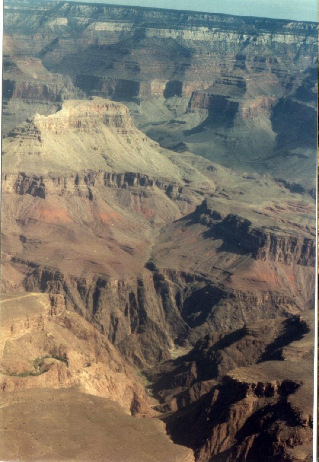
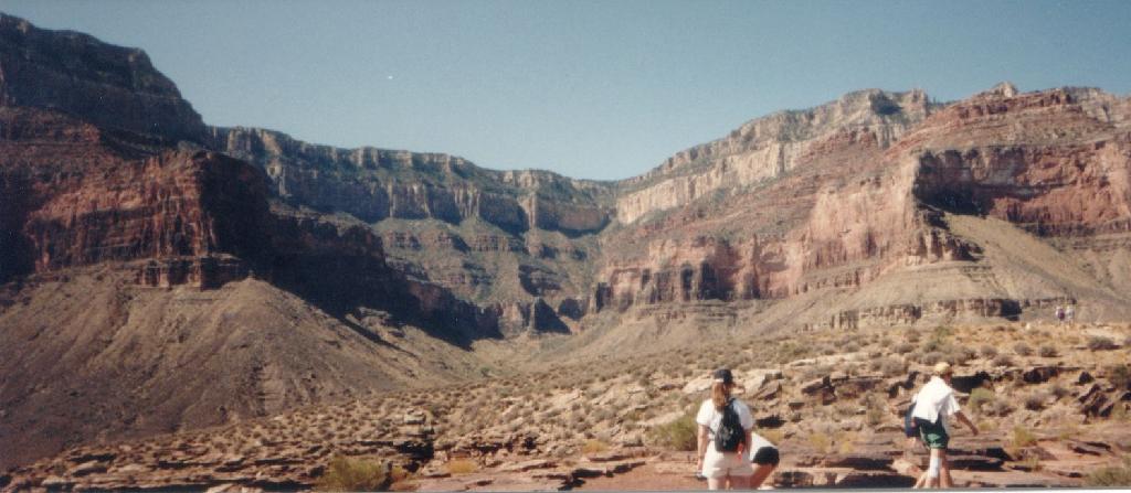
#3) Looking down into the gorge from Plateau Point. Approx 1100 ft down to the river according to a sign posted nearby. And there are no
guardrails on the rocks. You can walk right up to the edge! I think this is mostly
Zoroaster granite
according to the USGS topo map. The rock above that is metamorphic - produced by heat and pressure.
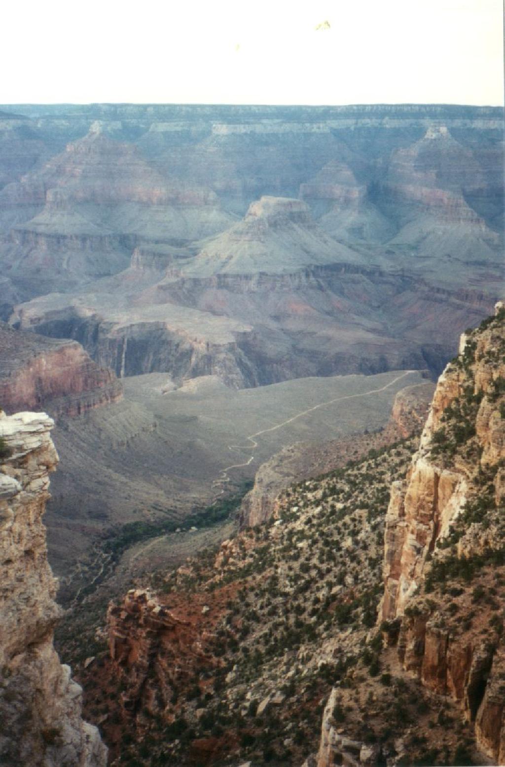
#4) Another photo from the South Rim. The light colored Coconino Sandstone layer is visible in the distance. The Bright Angel Trail and
Plateau Point Trail leading out to Plateau Point are visible at the bottom. Plateau Point is
probably about 4 miles from
here as the crow flies. 6.1 miles as the feet walk.
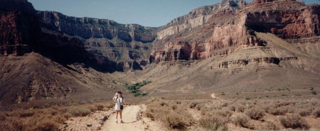
#5) Panarama view looking back up the Bright Angel Trail from Platea Point.
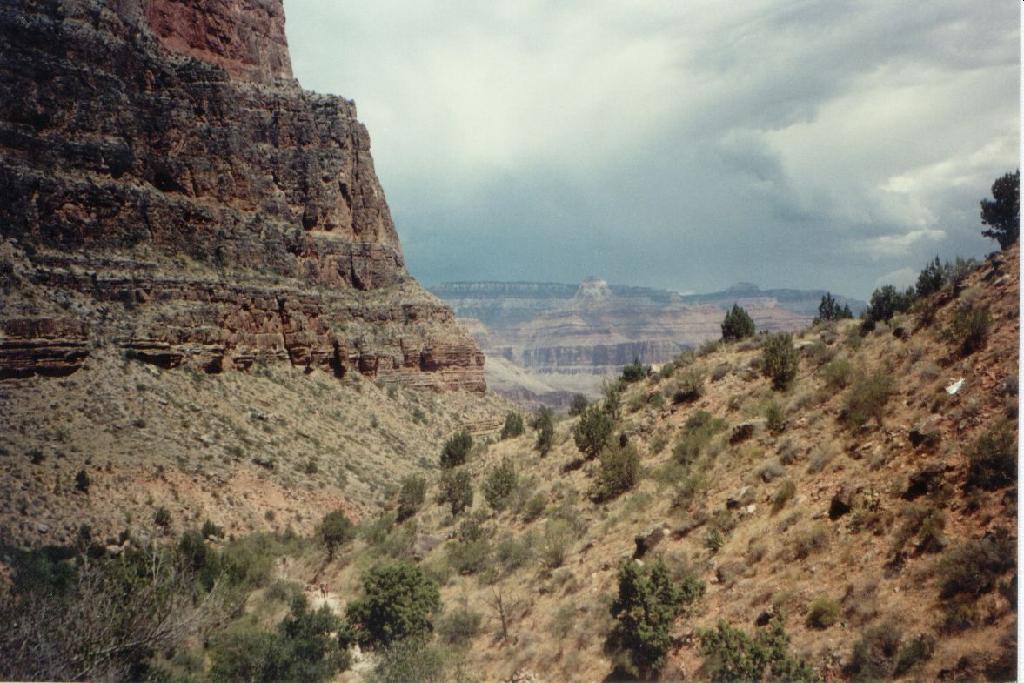
#6) A view across the Canyon from part-way down the South Rim face on the Bright Angel Trail.
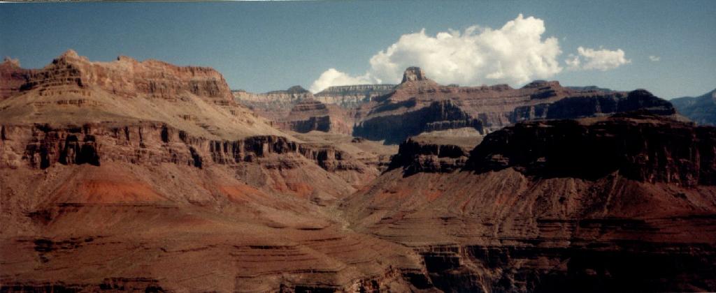
#7) Panarama view looking back up to the South Rim from Plateau Point. Clump of green is Indian Garden some 1.5 miles distant. Another
1.5
mi or so to the base of the face and then about 3000 ft up with many switchbacks totaling about 3 mi. Explanation on the formation of the
Canyon provided by the park ranger indicates that the main fissure of the canyon was formed by a crack in the earth as the rock layers
below
were pushed up. Over time the exposed rock faces crumbled and eroded with rain, wind, freezing, thawing, etc. Most people think of the
Grand
Canyon as a big hole in the ground. However, the rim is almost 7000 ft in elevation - higher than the highest mountain in the Smokies.
Where
Kathy is standing is somewhere around 3500 ft above sea level. The river at this location is approximately 2000 ft. Indian Garden in the
background is about 500
ft higher in elevation. The dimensions are enormous!
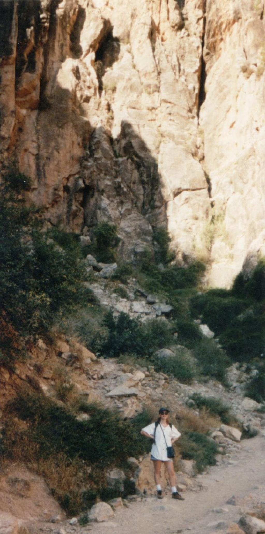
#8) Kathy Dugan Schumann posing before an imposing rock face on the Bright Angel Trail that looked and felt like limestone (although it couple
be a sandstone). Taken
with a panarama camera, but still couldn't
capture the true dimensions. Lots of it, representing many years of deposits.
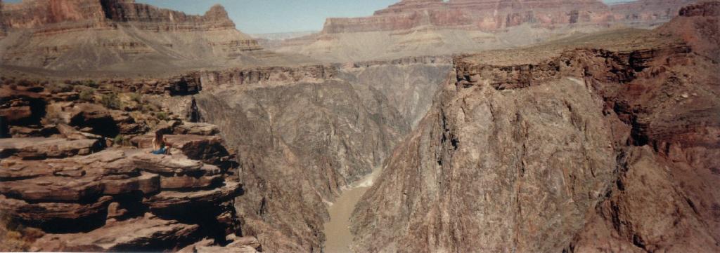
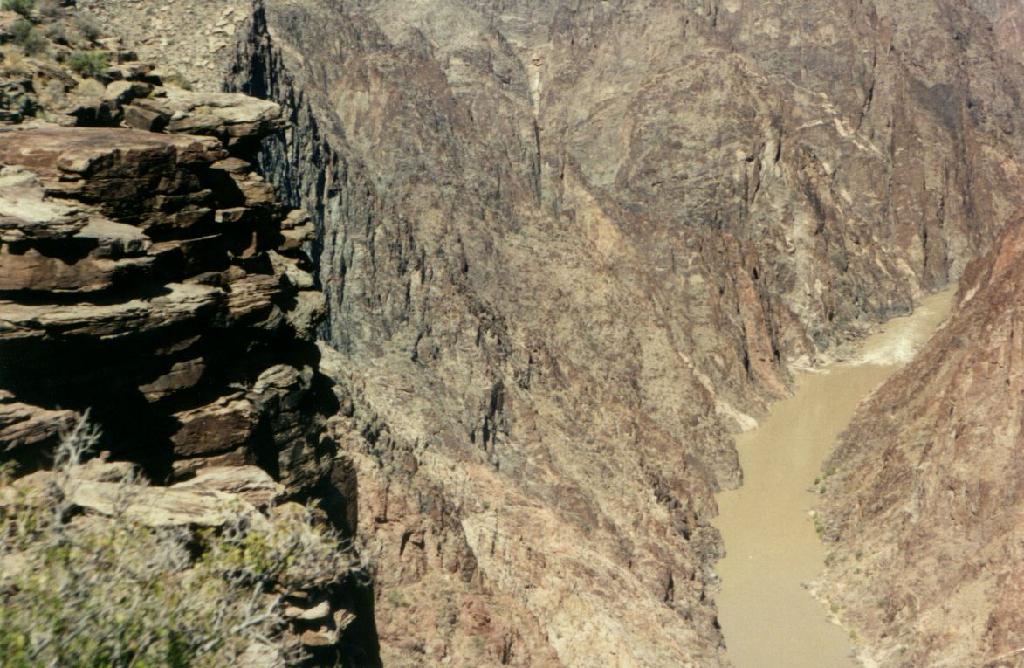
#9) Panoramic view of the last 1100 ft into the gorge at Plateau Point. This is apparently a cut through Zoroaster Granite. The cut is attributed
entirely to erosion by
the
Colorado River. At present rates, it would have taken approximately 12 million years to cut the entire Canyon. However, others think it "only"
took 6 million years, so it must have been cutting faster previously..
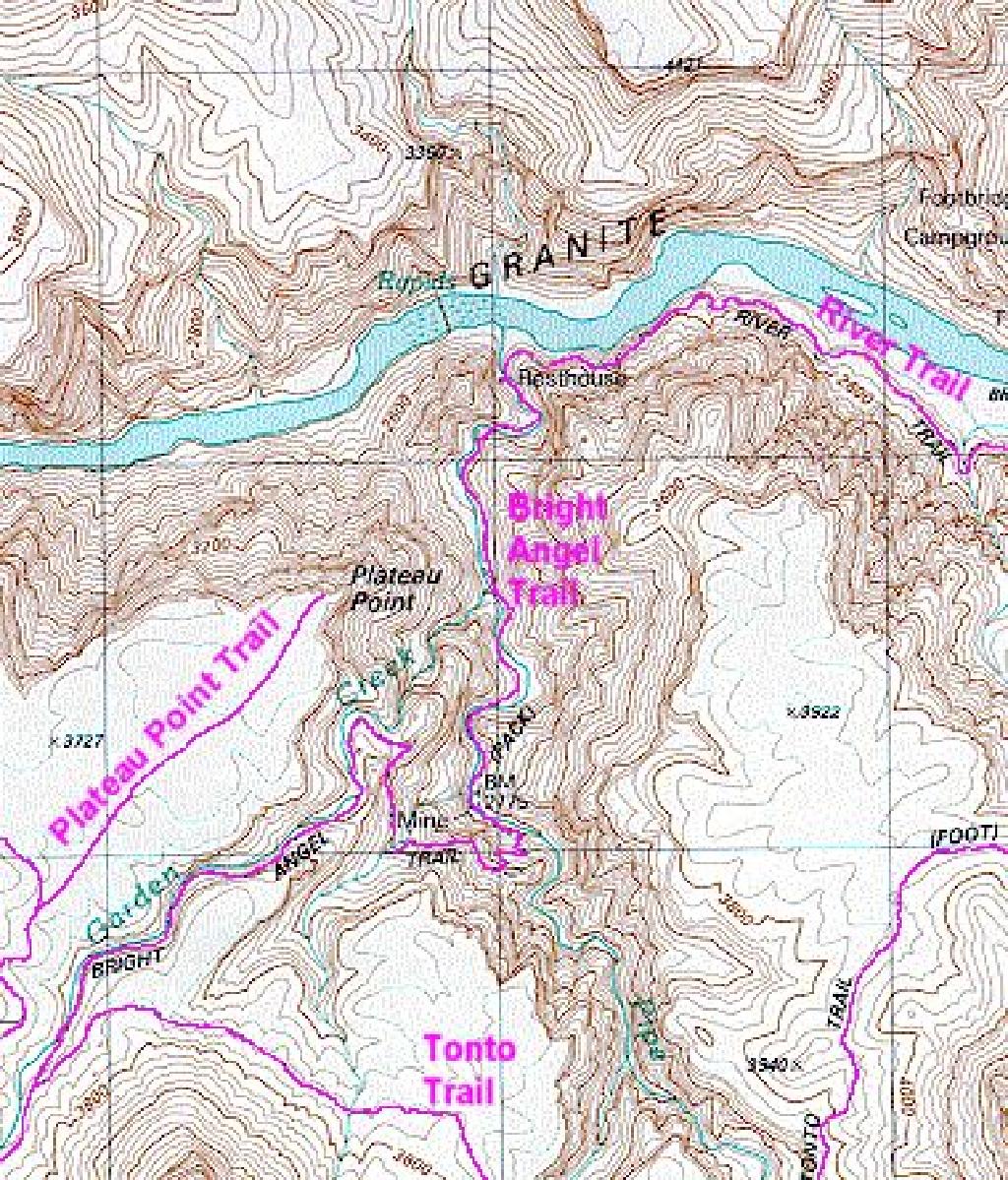
Topo map of Plateau Point and Bright Angel Trail.